
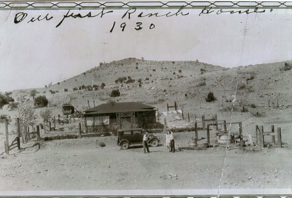
The original headquarters built in 1923. Notice the young cottonwood tree on the lower left and the holdup near the car.
The Ranch lies at 5100’ elevation, just west of the Continental Divide in southwest New Mexico. Although mountainous, the land is primarily rolling Chihuahuan grassland, one of the most biologically diverse arid regions in the world. A one-hour drive south of Silver City, the Pitchfork is six miles from the nearest neighboring ranch and consists of slightly more than 11,000 checker-boarded, split-estate acres (we own the surface, the government or someone else owns the subsurface mineral rights), 5,160 deeded, the balance state and BLM lease land, as shown on the Pitchfork Area Map below.
The dominant landmark is Soldier's Farewell Hill (6173’) near the historic Butterfield Trail and way station #19. In the late 1880s, this land was part of the historic “Diamond A Ranch” or “Gray Ranch” in the New Mexico Bootheel. Later known as the "McDonald Brothers" or "Bart McDonald place," these lands have been in cattle production for well over a century. In the late 1890s a Civil War veteran gave 5-year old Bartley McDonald a heifer, registered the three-pronged "pitchfork" brand for the boy and thus the ranch name and brand.
"Native grasslands are now among the world's most endangered ecosystems." "Springs ecosystems (which include ciénagas) are among the most threatened ecosystems on Earth." This ranch has both. Archaic peoples, Athabaskan, Mimbres, Apache, Spanish and finally Anglo settlers lived along the 48-mile long Burro Ciénaga, a unique desert wetland and the ranch’s most important feature. A Spanish term meaning "slow moving water or marsh," the ciénaga is perennial and bisects the ranch north to south, two miles above ground, seven miles balance subsurface, fed by perennial Ojo de Inez (now Ciénaga Spring) and canyons that drain from a 58-square-mile watershed. Extreme flood and drought cycles, eradication of beaver, presence of sheep of Spanish settlers, and corporate cattle overstocking in the late 1880s, agricultural re-contouring and the absence of fire have dramatically altered the area's natural marsh balance and deeply entrenched the ciénaga.

The headquarters and outbuildings today and the same cottonwood tree 90 years later.
The northern quarter (that we are “re-wilding”) and southern three-quarters of the ranch, about 2,500 and 8,500 acres respectively, are set apart by Separ Road, a Grant County maintained dirt road that runs 30 miles from the towns of White Signal on Highway 90 to Separ on I-10. The Pitchfork — surrounded be seven ranches, with no urban encroachment — is midway between the two.
Raised in Phoenix, living in Casa Grande, Arizona, for 32 years, we bought the ranch in 2003 and retired to the property, permanently living at the ranch headquarters. The buildings were refurbished or expanded in keeping with the period of their original construction, starting in 1923 through the early 1950s.
We are following restorative management practices and natural climate solutions, planning to leave the ranch to an entity that will maintain its historic integrity, support ranching, honor the conservation easement and protect these open spaces.

Original ranch founder's threes sons. Barley, Taylor and Jerry.
The overarching goals for this ranch are habitat repair and carbon sequestration, using "flood-n-flow" based restoration practices and accompanying sediment deposition to nudge the ciénaga and surrounding land toward its pre-settlement condition — to get the water back. Ongoing installation of grade-control structures is helping the ciénaga and surrounding land reclaim itself and reconnect surface and groundwater. Goals are to: refurbish the headquarters while retaining its historic character, monitor photo points and piezometers, perform water and soil data collection and mapping, raise the ciénaga bed, sequester a portion of the legacy load of atmospheric carbon, restore traditional and uplands, improve infiltration rates, fix roads, rebuild the cattle herd, provide science, research and education opportunities, protect the archaeology, improve habitat for wildlife and imperiled plants and animals, restore low-intensity fire and prevent range land fragmentation.
Burro Ciénaga Watershed & Surrounds
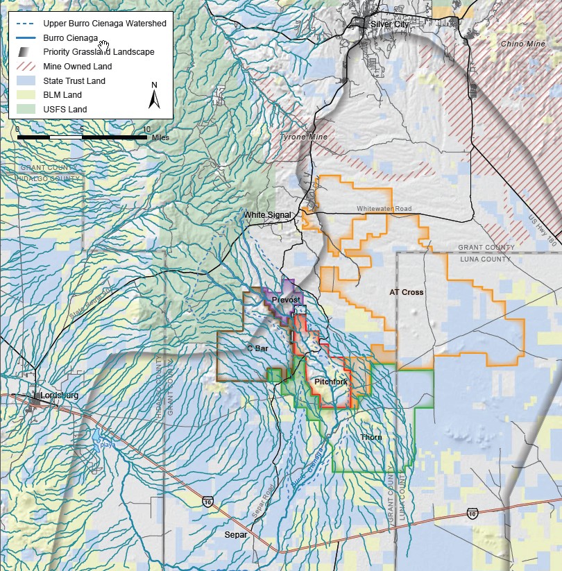
Map credit: Steve Bassett, The Nature Conservancy
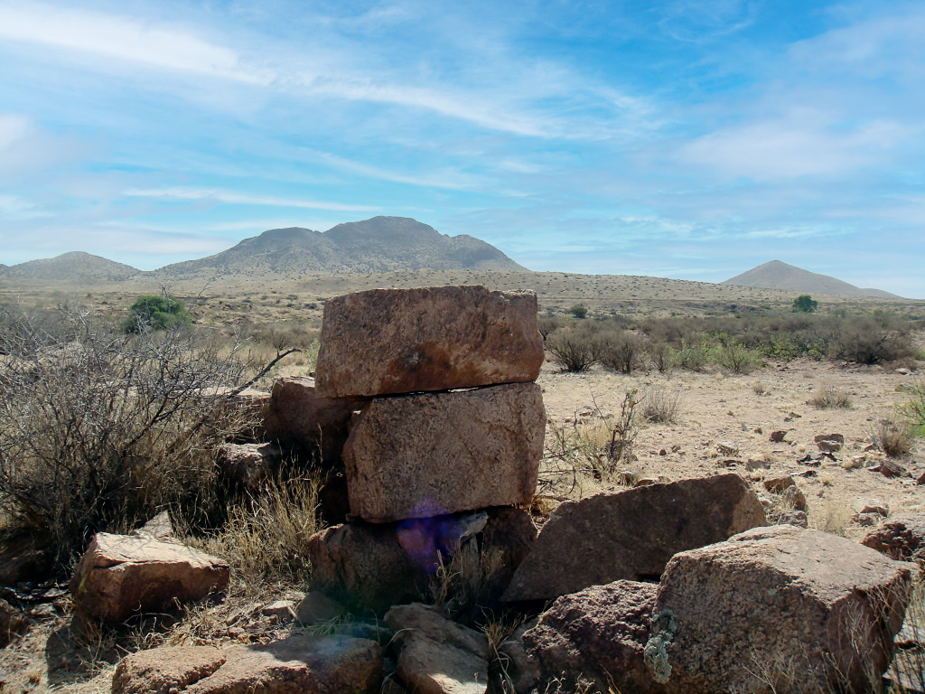
The historic Butterfield Trail goes through the Pitchfork Ranch and the remains of Soldier’s Farewell Station stage — located at Soldier’s Farewell Springs (Los Penasquitos) between Cow Springs (Ojo de la Vaca) and Steins (El Peloncillo) — stop is pictured here, located just off the ranch, named after Soldier’s Farewell Hill, an area landmark on the ranch.
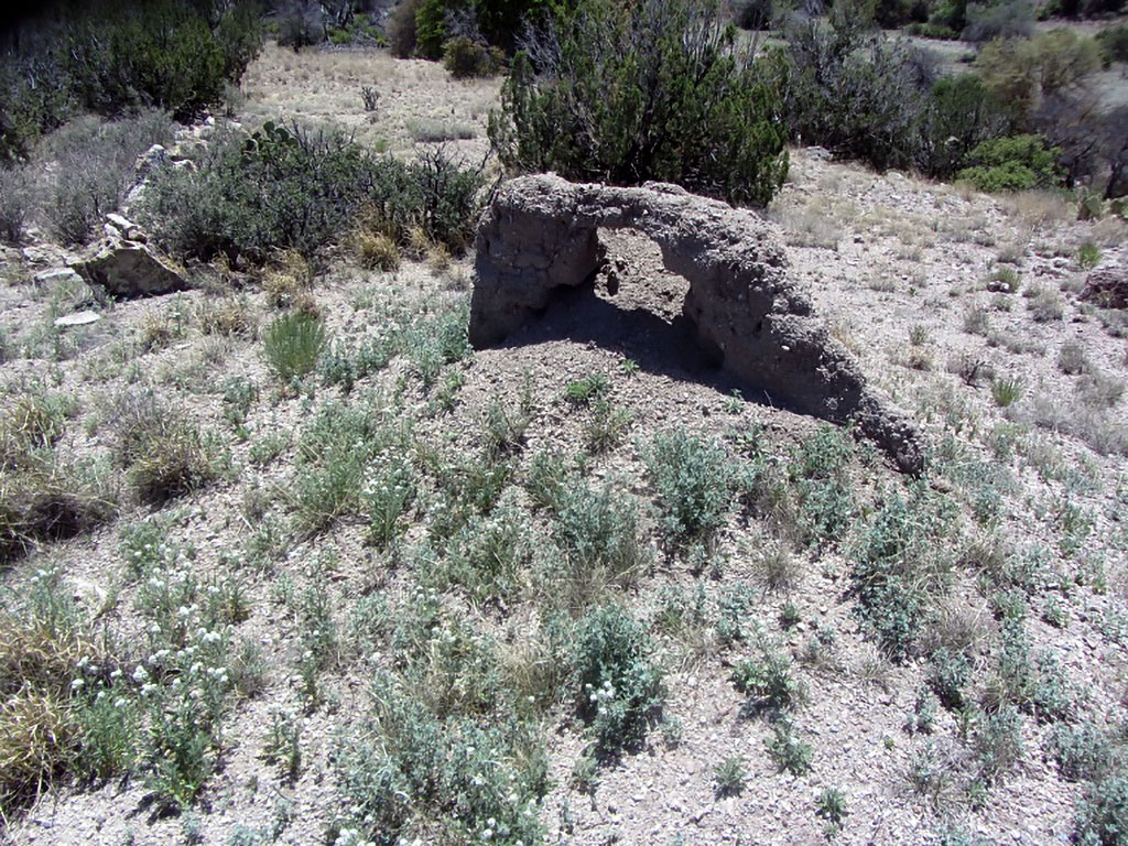
This is all that remains of the first homestead from the early 1890s. Legend has it that founder of the McDonald Ranch (one-third of which is today’s Pitchfork Ranch), Jeremiah McDonald, slept in this already abandoned homestead when he first arrived.
Dynamite shack near an abandoned Perlite mine on the ranch.

Grave site on an adjacent ranch.

A nearby grave: Gustova Glaze, 1906 – 1918.

Another grave on a neighboring ranch of a young girl murdered in the early 1920s.

Richard Green II and I spent two full days removing old wire from the main corral. We filled five large grocery bags with wire left over from the last hundred years.

This metal button was found at a long-abandon 1890s homestead. It has the name of the manufacturer and address that we tracked down to a street in London where to company remains in business.

Bill Zeedyk found this cavalry canteen when designing one of our early restoration projects. From April to August 1886, units of the 6th Cavalry and 13th Infantry were stationed at Camp Henley during the final campaigns against the Apaches.

Before commercial pipe with couplets was developed and replaced this older construction method for installing water pipe, wet concrete was poured in a mobile, in situ mold creating a continuous pipe — as shown here in a remnant piece of poured concrete piping found on the Pitchfork.
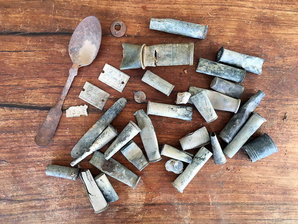
The spoon, tweezers, metal labels, bullet shells and other metal were found — along with the button — at the first area homestead, all of which is likely more than a hundred years old.

We try and use local material for grade-control structures and other restoration efforts. Every cattle ranch has large piles of old barbed wire. We failed to perfect a technique for using these old rolls of wire, but intend to try again.
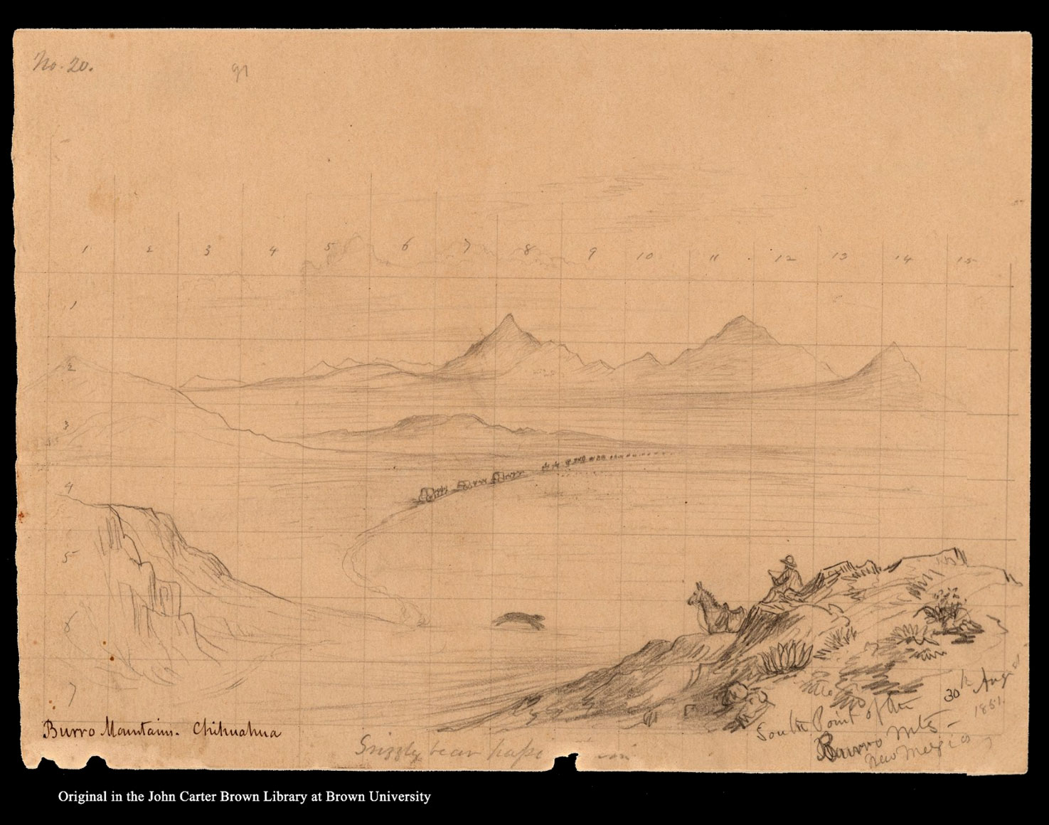
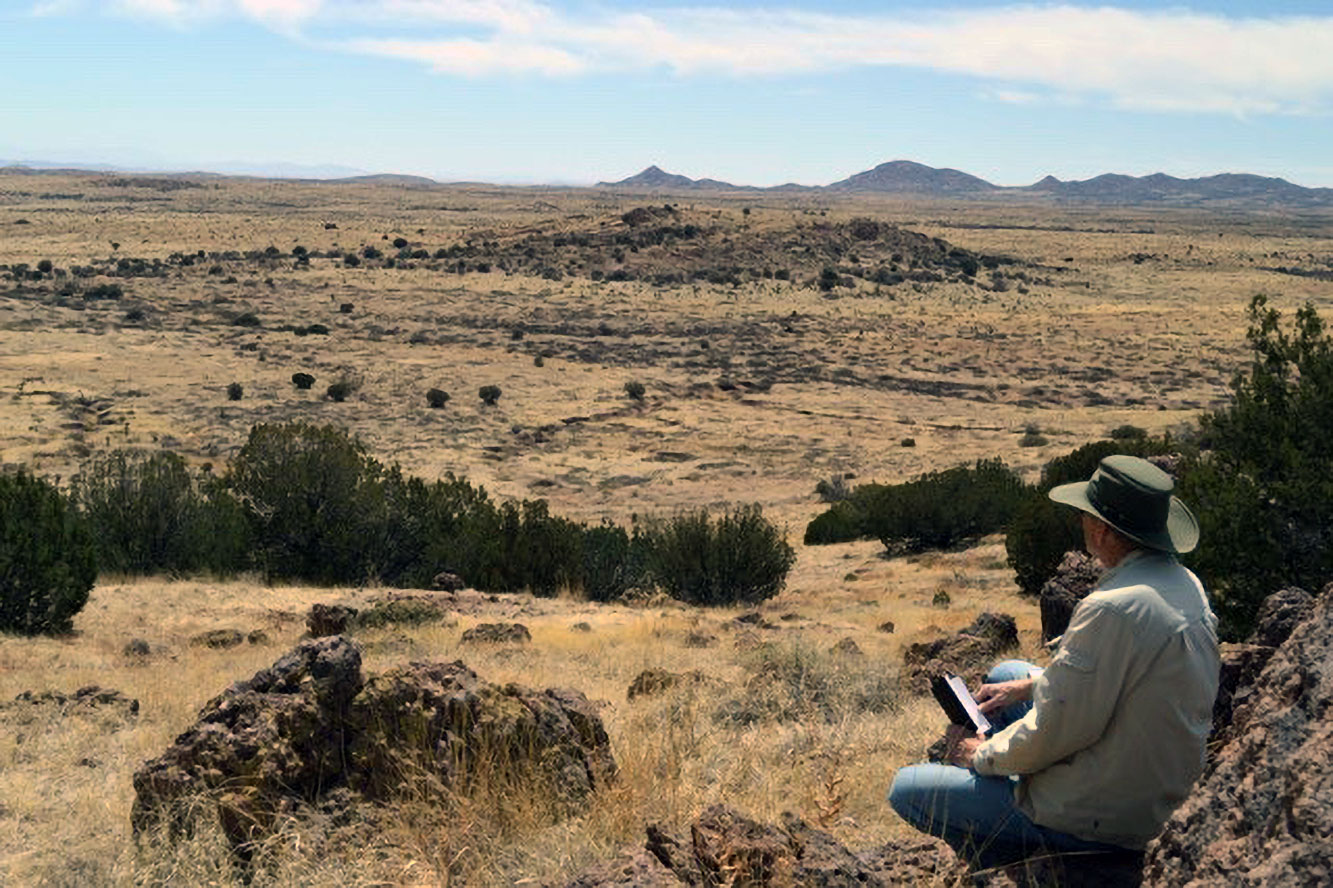 The above drawing is by John Russell Bartlett. To the right is a photograph of the exact location where Bartlett portrayed himself on August 30, 1851. The United States Boundary Commission was surveying the yet established Mexico-United States boundary after the Mexican American War and passed through the land that became the McDonald and eventually Pitchfork Ranch. We were living here for less than a year when we heard a knock on our kitchen door, the first of less than a dozen since living here. It was Jerry E. Mueller, retired professor from the University in Las Cruces, New Mexico and his two grandsons. He asked for permission to look for the site on the ranch where Bartlett drew this sketch when the Commission passed through this land, headed for what would become Arizona. He found the location, returned later and I went up there with him and took this photograph of Jerry seated where Bartlett had pictured himself 155 years earlier.
This was an era before the invention of the camera, so artwork was the mainstay for such tasks. Mueller published An Annotated Guide to the Artwork of the United States Boundary Commission, 1850 – 1853, Under the Direction of John Russell Bartlett in 2000 where he reviewed many sketches by Bartlett and the artist who worked with him. Mueller also completed Bartlett’s autobiography in 2006: Autobiography of John Russell Bartlett.
When Bartlett passed through this land, he had earlier rescued Inez Gonzalez, a young Sonora, Mexican girl who had been captured by a renegade group of Pima Indians and sold to an American trader who was taking her to Santa Fe to be sold into domestic work, prostitution or whatever would return the most money. Bartlett rescued Inez and she accompanied the Commission for several months before they returned to her family in Sonora, a tale that is fictionalized by Nancy Valentine in J.R. Bartlett and the Captive Girl, 2018. When the Commission passed through here, Bartlett renamed a spring on the ranch in her honor, Ojo de Inez. Bartlett recounts these events in his two volume Personal Narrative of Explorations and Incidents in Texas, New Mexico, California, Sonora and Chihuahua, 1850 – 1853, 1854 and explains re-naming “this spring Ojo de Inez, or Inez’s Spring, after her. I believe it is known to the Mexicans as Ojo de Galvin or Hawk Spring?” (page 362 this can be removed) The spring remains yet today, titled as Ciénaga Spring, although Ojo de Inez can be found on older maps of the Southwest before statehood.
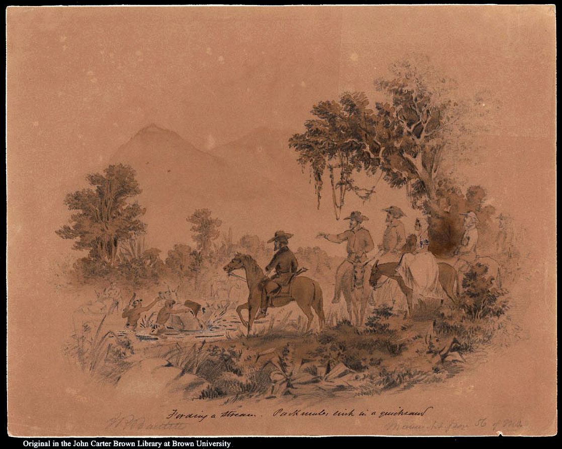
This drawing illustrates what one scholar described as “an idealization of the difficulties of the march” where the survey party muleteers struggle to save pack mules sinking in quicksand, Bartlett gesturing “with noblesse oblige toward the scene as if he were giving a lecture at the Athenaeum” while Inez remains perched, side-saddle atop a mule, attired in a typical Catholic, lace headscarf, shoulders draped with a quechquémitl and a cotton, ankle-length dress as she sits, mounted side-saddle. Along with hundreds of work from the Commissions two-years labor, this sketch, John Russell Bartlett, Fording a Stream, Packmules Sink in Quicksand, September 13, 1851, 10” x 12 ¾”, Pencil and Sepia wash is preserved at the John Carter Brown Library, Brown University, Providence, Rhode Island.
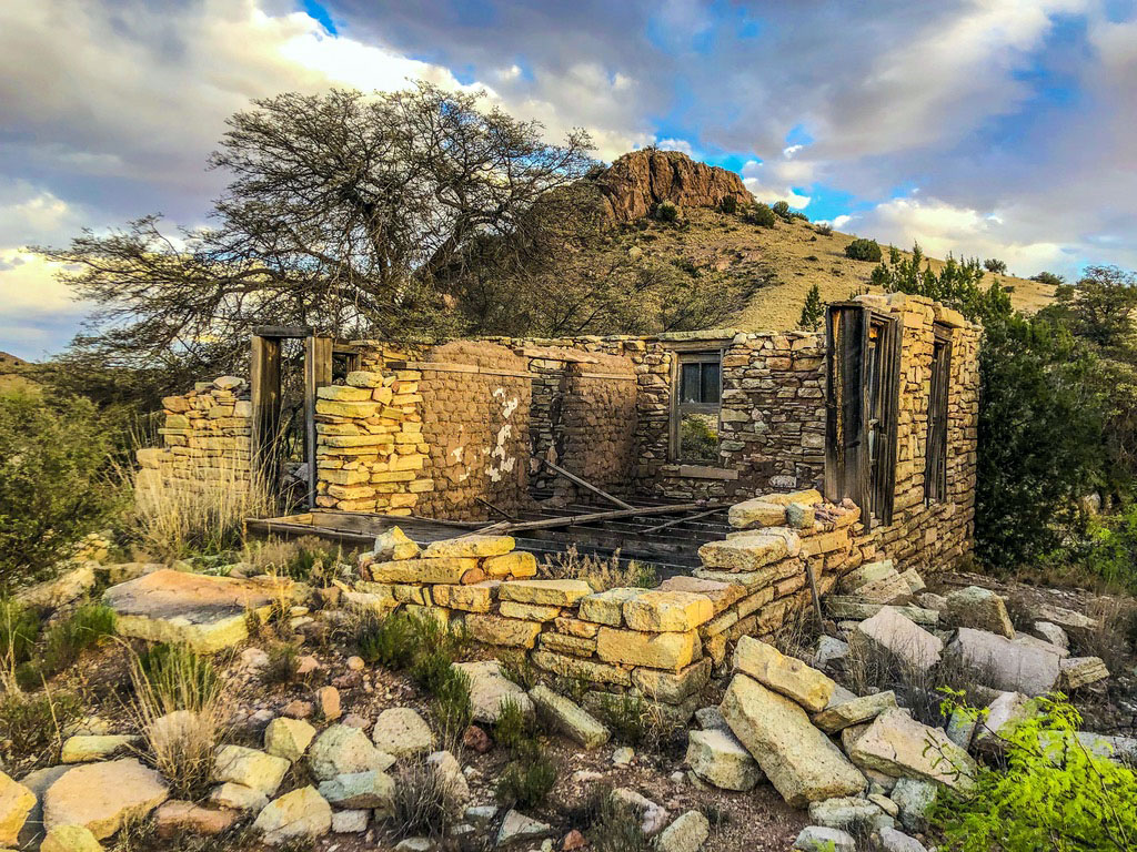
Al O’Brian built this house in the early 1930s with rock harvested from an abandoned calvary building on the ranch. The original structure was constructed with limestone material taken from a quarry on the ranch that also served as a source for a number of Civilian Conservation Core (CCC) structures that remain throughout the area.

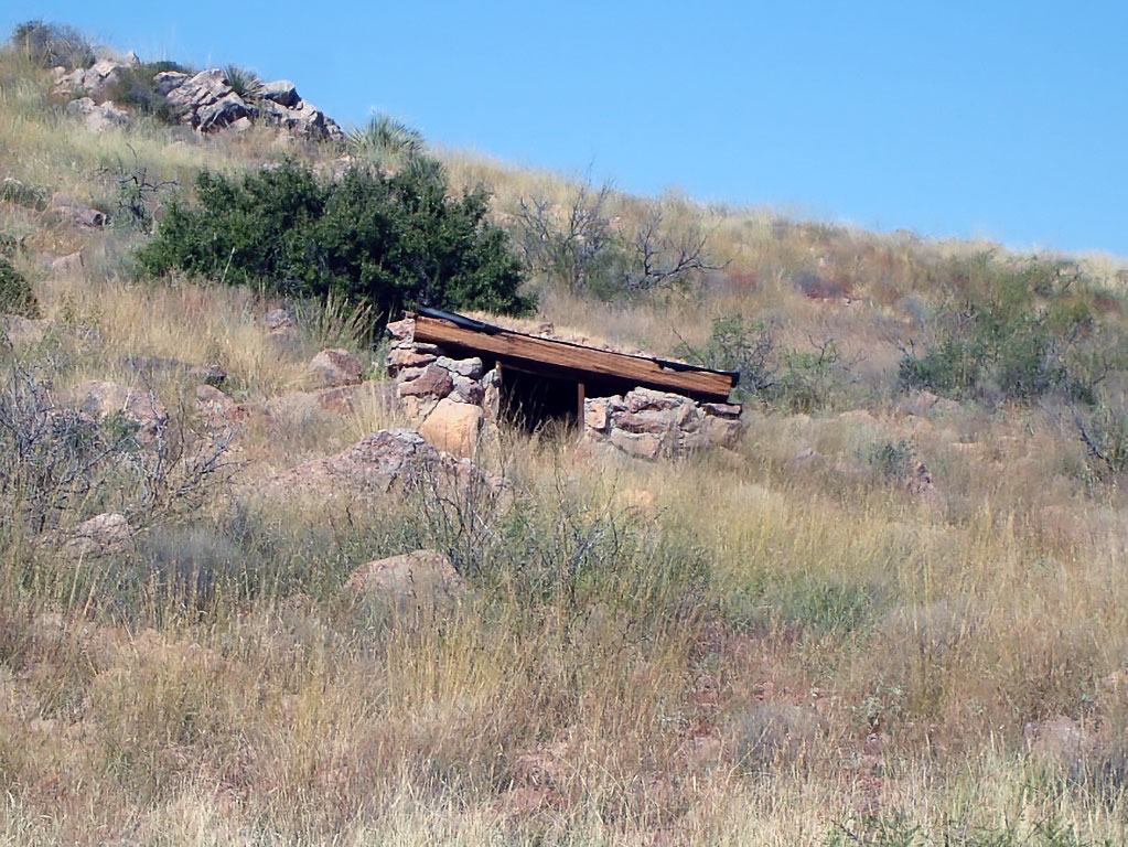
The Ray Gunn’s stone and tree-trunk dugout home predates the Al O’Brian house by several years and sits next to Gunn Canyon, one of the three large canyons on the ranch that drain into the Burro Ciénaga. An elderly neighbor lady told us she and her husband once leased and ran cattle on the Pitchfork Ranch and hired Ray Gunn as a day labor during the roundup. He was apparently difficult to work with and their Hispanic ranch manager told her at the day’s end: “Yo trabaho con el pistola no mas.” (I’ll not work with the pistol any more.)
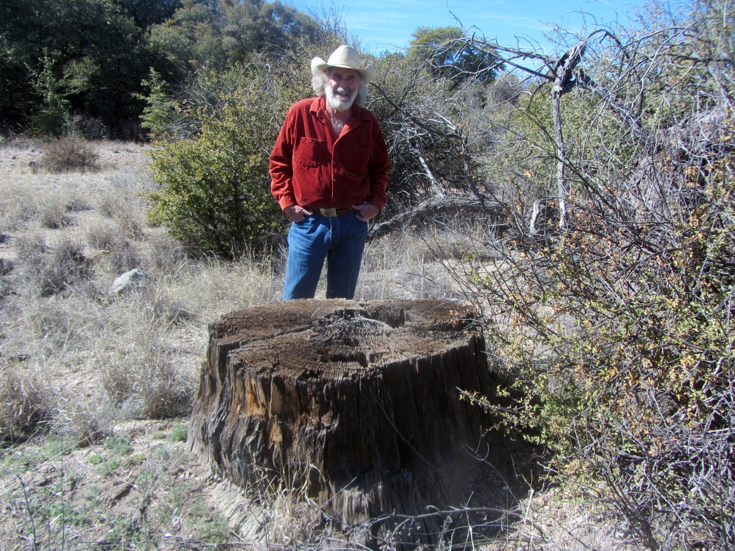
Located on the north portion of the ranch, this old natural artifact illustrates just how different the desertified Southwest is from the habitat the Spanish found when they arrived. There are no longer trees anywhere near this size any on the ranch.
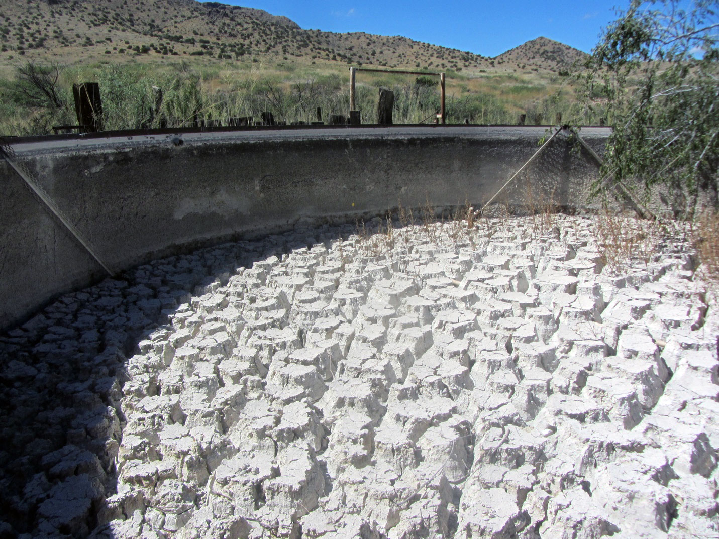
Like most historic cattle operations, this ranch has 6 windmills and steel rims used for storing water. Two have long been out of use, but the others remain operative. Because of the climate crisis, 3 of the remaining 4 have gone dry, 2 recovered and one persists uninterrupted. The climate crisis is noticeable here in a number of ways, here lies debris and sediment gathered over the last century or more on the floor of a dried up steel rim.
![]()
2013
![]()
2010
![]()
2007
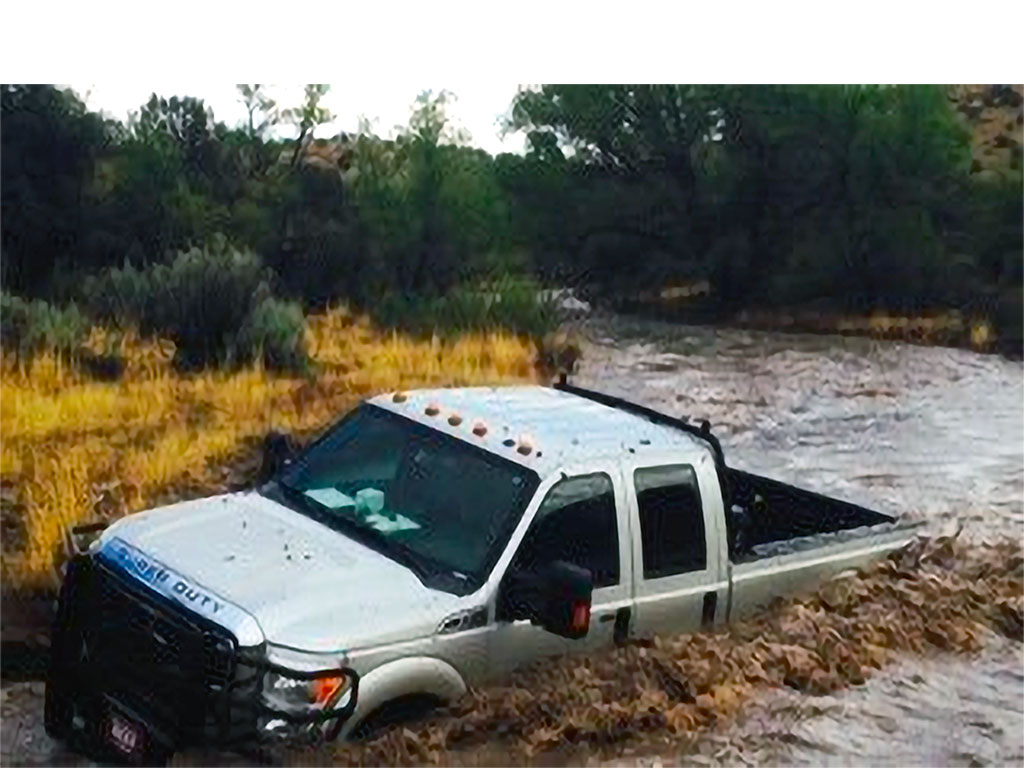
A neighbor stuck on Separ Road, 2014